Need a Walk or a Bike Ride?
Do you want to go on a day hike? A trail run? A bike ride? Here are two great trail systems in South Charlotte and another trail just south of Charlotte in the Indian Land Panhandle. Each trail has its own personality. But best of all, all three have excellent access and parking.
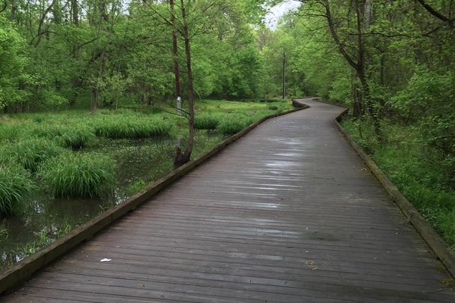
The McMullen Creek Greenway, Lower McAlpine Creek Greenway, Four Mile Creek Greenway is a 5.8 mile connection of three trails. These trails are marvelously walkable, rideable, and runnable, if runnable is even a word. The surface of the trail varies from packed gravel to dirt to asphalt, but it is well-maintained, smooth, and wide. Be extremely careful on the wood bridges if they are wet, especially so if you are riding a bicycle. The slightest sudden turn or squeeze on the brakes can lead to a dangerous crash. There are so many great things about this trail system, access and parking being just two. There is abundant parking at both ends and in the middle. The Rea Road / Bevington Place entrance has a parking lot and street parking. There is a nice little shopping area across the street from the trail entrance with a Trader Joe’s, Starbucks, and a few casual restaurants. Birdhouse on the Greenway, a frequent contributor to our magazine on all things birds and butterflies, is also there. But please don’t park in the strip mall lot if you are only using the trail. The Pineville – Matthews Road parking lot is huge. And the Johnston Road parking lot has a water fountain and clean indoor bathrooms – always a plus.
The Anne Springs Close Greenway is a spaghetti plate of single-track trails. Unless you hike or ride these trails regularly, you will probably need a map from one of the trail entrance kiosks. There are also fee boxes at the trail entrances with the $5.00 daily use fee going toward trail maintenance and supporting activities. The daily fee is well worth the price if you use the trails occasionally. However, you can become a member for an annual fee of $49.00 for an individual or $99.00 for a family and use the trails as often as you like. Over the years the trails have become rooty and rocky from a lot of mountain bike wear and tear. I had to quit riding these trails after a while (about the time I turned 55) because they were too hilly and technical and because I just don’t bounce as well as I once did. If you ride a bike on these trails, you will wreck. But they are outstanding scenic trails for a walk or a day hike. We who live in the South Charlotte / Fort Mill area are fortunate to have the sports complex and trail system so close. It’s a treasure. Put on your day pack or load up your mountain bike. Again, watch out for wet bridges. But don’t miss out on this as a personal activity or as an opportunity to get outside with your grandchildren.
The Walnut Creek Park segment of the 12 Mile Creek Trail is a place I don’t want to write about because, honestly, I want to keep it all to myself. The 3.5 mile trail along 12 Mile Creek will eventually connect from the Walnut Creek sports complex off of 521 to Waxhaw on Providence Road. The trail is mostly single-track with an outstanding bridge system. It is hilly but not ridiculously so. It is very walkable and rideable on a mountain bike for anyone who is reasonably skilled. Unlike the trails at Anne Springs, if you wreck your bike on the Walnut Creek trails, it’s probably a mistake you made rather than the trail trying to kill you. I would not try riding a townie on these trails and definitely not on a road bike. The seven-mile out-and-back from the sports complex takes about two hours of steady hiking. A crazy cool suspension bridge at the 3.5 mile mark connects South Carolina to North Carolina, which then adds almost another mile to the trail after the bridge should you decide to continue your hike. It’s a fantastic hike for you and for your older grandchildren. And a great mountain bike ride.
There are many other multi-use trails in our area. I selected the three above primarily for their easy access and great parking. For more information on area trails, please click on the Carolina Thread Trail Map.
Photo by Joy Lashay


